Theguardian.com – Mar 2017 – USA |
Don’t pretend that this cartographical conundrum hasn’t been keeping you up at night.
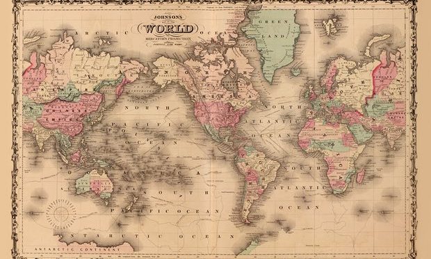
The Mercator projection has long been a topic of debate within mapping enthusiast circles. It is almost ubiquitously used in contemporary maps and atlases, and many would recognize its projection of our planet. Western-Europe at the center of our globe, with a sprawling northern hemisphere in comparison to it’s southern half.
The Mercator projection distorts out planet. South America and Africa appear drastically smaller than they are in reality, with areas such as Europe, America and Greenland being inversely enlarged. Schools in Boston however are looking to shake things up for its students and restore some geographical truth to their classrooms.
The maps they use will now feature the lesser known Peter’s projection, which cuts US, Britain, and the rest of Europe down to size.
Many are hailing the move as an important step in removing colonial thinking from contemporary society. These new maps will remove the focus and exaggerated sizing of imperialist powers. It is hoped this slight shift will help promote a more universal and truthful understanding of Earth for future generations, moving away from western-centric discourses of our planet.
To read the article in full, please click on the reference title above.

